A few years ago, I somehow convinced a group of 3rd and 4th year architecture students to spend their days counting boats and canal piers across Thonburi instead of sitting in air-conditioned studios. Now they’re about to graduate already. At that time, some people probably thought the topic sounded strange. Why count small boats? Why look at old canal piers? Why spend hours observing movement patterns in waterways that many people assume are already obsolete?
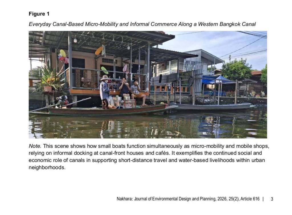
What started as a small student research exercise slowly became a much bigger spatial investigation into Bangkok’s western canal system. We surveyed active canal routes, documented piers that still function as both embarkment and disembarkment points, mapped movement patterns, and counted more than a thousand small boats operating within the Thonburi superblock. Many of these canal routes are not isolated at all. They already connect to bus routes, informal feeder systems, roads, markets, temples, communities, and even BTS/MRT stations within reachable distance. In other words, parts of Bangkok already contain the foundations of a collective first-mile and last-mile mobility network hidden inside the canal system itself. The infrastructure is mostly already there. The canals exist. The routes exist. The communities still use them. The boats are still moving every day. Unlike many futuristic mobility proposals that require massive investment and decades of implementation, this system survives quietly through everyday practice.
Sometimes only small adjustments are needed. Better pier access. Safer stepping points. Connected walkways. Integration with transport planning. Recognition that canals are not just drainage infrastructure or scenery for waterfront cafés. They are movement corridors. But there is one major issue that keeps appearing again and again.
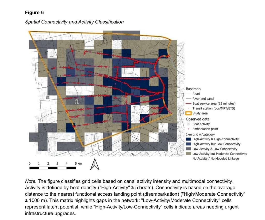
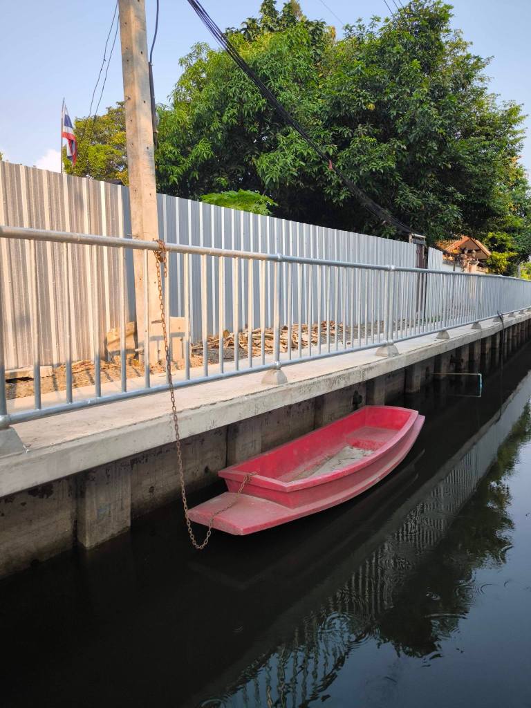
For decades, Bangkok has often approached canals through flood-control engineering alone. Concrete walls get built vertically along canal edges, removing the soft relationship between people and water. Technically, the canal remains. Functionally, access disappears. Once the embankment becomes too high or too rigid, small boats can no longer stop properly, people cannot climb up or down safely, and everyday mobility gradually collapses.
This is why the research became less about nostalgia and more about infrastructure logic. Bangkok does not necessarily need to “reinvent” water mobility from zero. In many places, the system already exists in fragments. The challenge is whether the city recognizes it before it disappears completely under concrete embankments and road-oriented planning.
Ironically, while cities around the world are discussing low-carbon mobility, resilient infrastructure, shared transportation, and climate adaptation, Bangkok already has a living mobility network floating quietly in its own backyard. Sometimes the future is not something entirely new. Sometimes it is something old that still works.
Read more in:
Chaichulee, S., Amphan, P., Satitanon, P., Jongraktanakit, P., & Yodsurang, P. (2026). Integrating Bangkok’s Western Canals for Micro-Mobility and Last-Mile Connectivity: A Spatial Analysis of Man-Powered Paddle-Boat Movement. Nakhara: Journal of Environmental Design and Planning, 25(2), p.616. https://doi.org/10.54028/NJ202625616

Leave a comment